Streets
There are 261 streets in the area that we cover and there are 156 blocks of flats. We are attempting to trace the development of every street and have created a file for every one of them which includes details of its history, the infrastructure (i.e. when the street was adopted by the Council, the installation or upgrade of services and maintenance of carriageways and installation of street furniture) and details of individual properties.
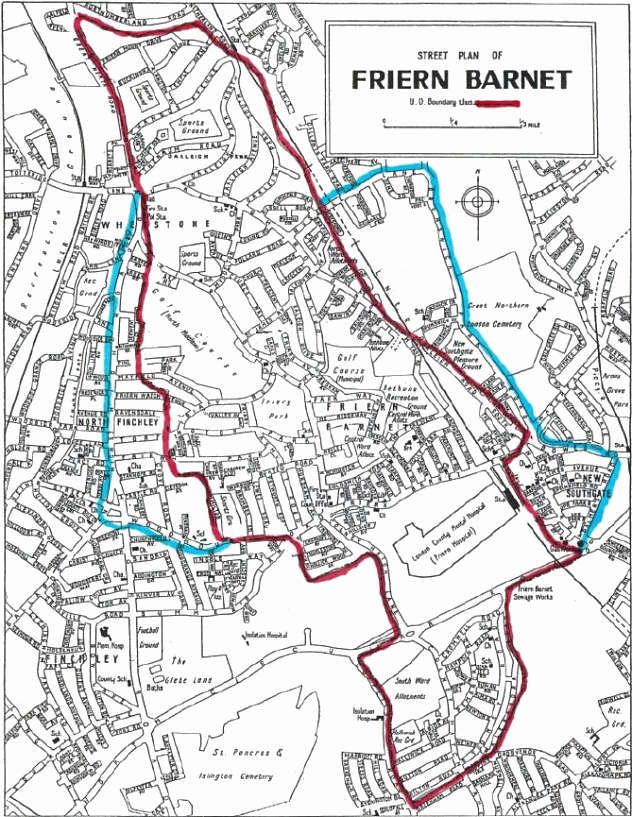
In this map from 1939, the area outlined in red is that of the former
Friern Barnet Urban District Council. The ones outlined in blue
are the additional areas covered by the Society.
Sources include extracts from Council Minutes of Friern Barnet Local Board (1884-1894), Council Minutes of Friern Barnet Urban District council (1895-1965), planning applications to Barnet Council (1965 to date), extracts from published sources (i.e. books on the area and items from local newspapers, catalogues, programmes etc.) and personal reminiscences of local residents and input from our members.
It should be noted that many of the early planning applications for the building of houses did not include the number of the property, mainly because this had not been allocated at the time of building and some properties are only shown by a house name. In both these cases a “?” is shown to indicate that the exact property number is not known.
It should be remembered that as streets developed, many of them were subsequently renumbered by the Council in co-operation with the Post Office. Where it is possible to correlate the old number with the new number, the entries are included under the current numbering system with a note in brackets of the former number. Individual properties are listed in numerical order and within each entry, by date - with the earliest dates shown first.
To get a comprehensive picture of changes to the many shops in the area please see our various SHOPS files.
If you have any information that can add to our knowledge please don’t hesitate to contact us.
Click on the relevant tabs to see the files.
What's New
We've added a Google Maps page showing the area as it is today.